
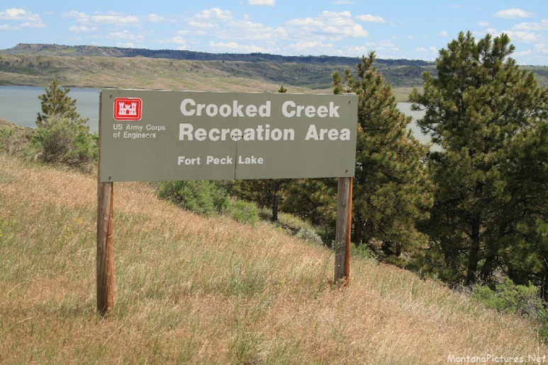
Welcome to the CROOKED CREEK Recreation Area
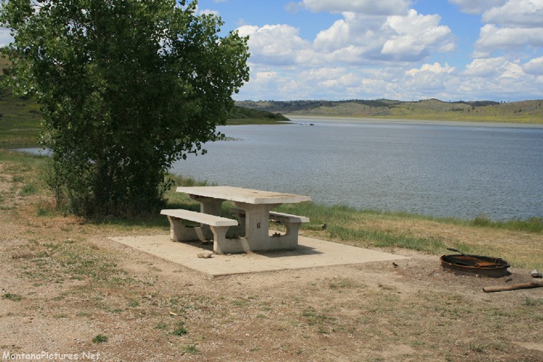
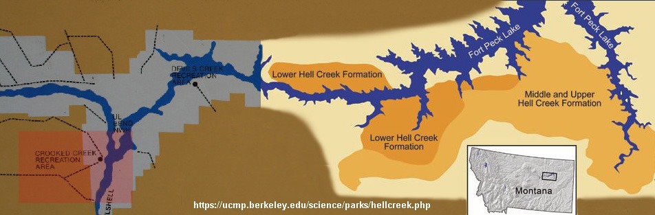
Do a search for pictures of the Crooked Creek Recreation Area on Fort Peck Lake and you will discover there isn’t much on-line. That’s where MontanaPictures.Net comes in handy. We show you both the popular and least visited locations that make up this great state of Montana. In this tour, we bounce down the gravel roads south of the 245,000-acre Fort Peck Reservoir, to show you the Cooked Creek Campground. The campground and fishing acess is located 50 miles off Highway 200 in Winnett in the middle of north-central Montana.
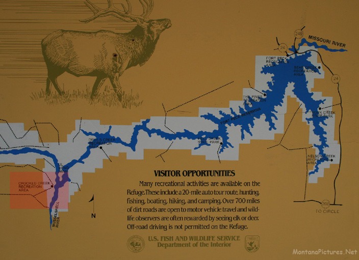
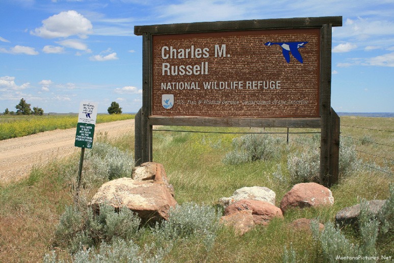
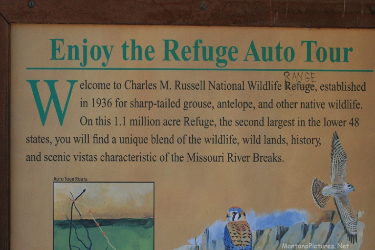
Created in 1936 and known as the Fort Peck Game Range, the 1.1 million acres was set aside to provide vital wildlife habitat. In 1976, the game range was renamed the Charles M Russell National Wildlife Refuge after Montana’s beloved cowboy artist. “Charlie” Russell provided the rest of the world a glimpse of his beloved Montana from the late 1800s until his the time of his death in 1926.
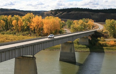
Making a trip to Crooked Creek is no easy task. Visitors need to be keenly aware of the weather before they enter the refuge via anyone of the 12 public access points in CMR. You will be fine in a passenger car, if you make sure the gravel roads are dry during the entire time of your visit. Hardy Ice Fisherman need to be prepared for unforgiving snow drifts. In the summer, don’t expect to hurry from one destination to the next. The “washboard” gravel roads and occasional “Blind Spots” make speeding a dangerous practice.
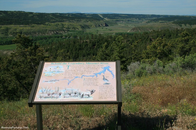
The “Missouri Breaks”
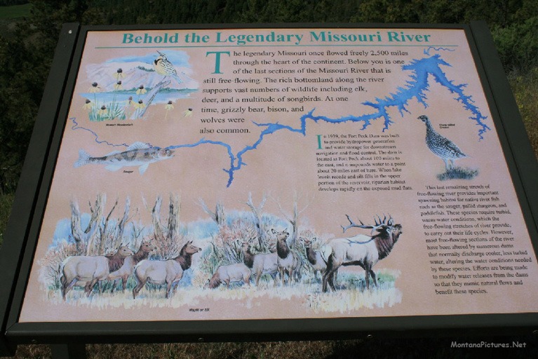
The “breaks” of the Missouri are deep chasms in the earth that extend like convoluted fingers outward from the river. Over time, great Pleistocene glaciers spread over northern Montana, literally pushing the Missouri River from its former course (now the Milk River, 60 miles north) southward. The river cut its present channel at the base of the glacier. When the glacier began to melt and retreat, its runoff formed streams that coursed across the soil and carved narrow, deep “coulees” that are now called the Missouri Breaks.
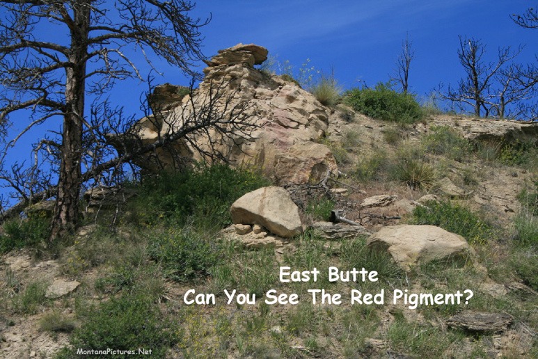
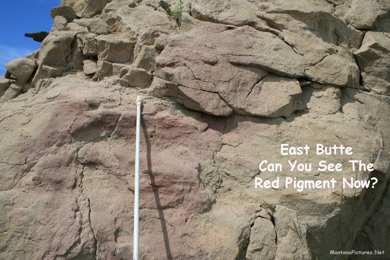
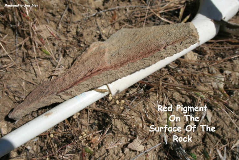
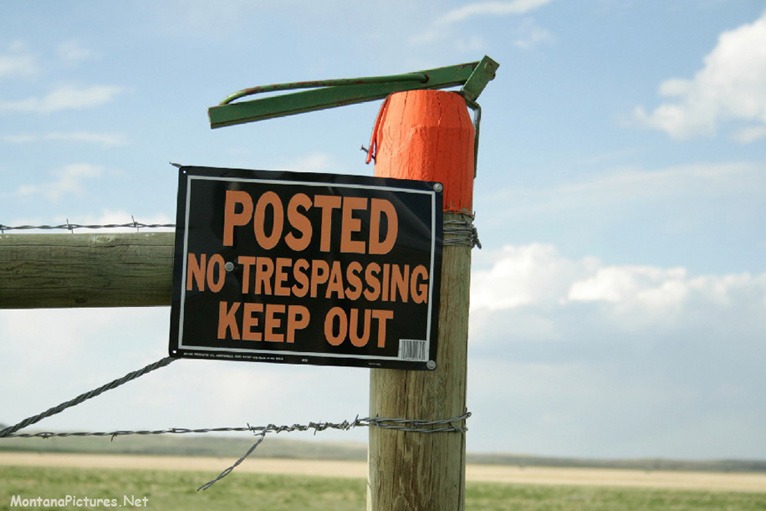
Ancient NO TRESPASSING Sign?
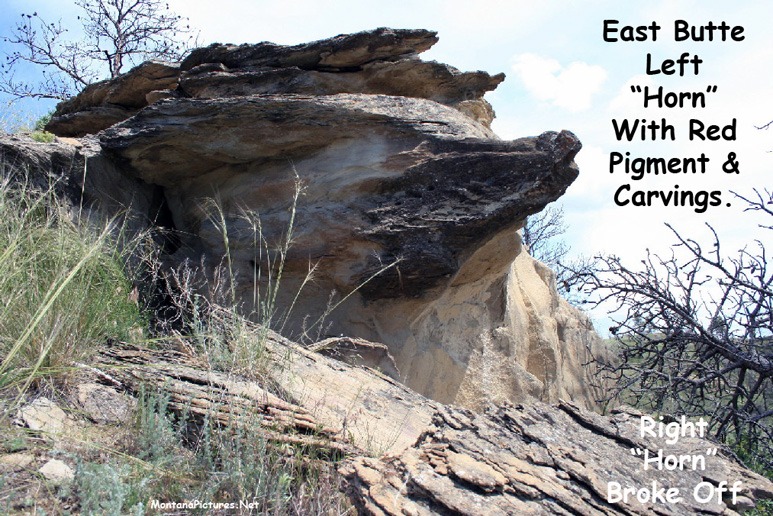
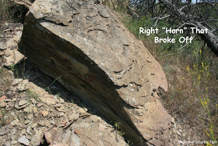
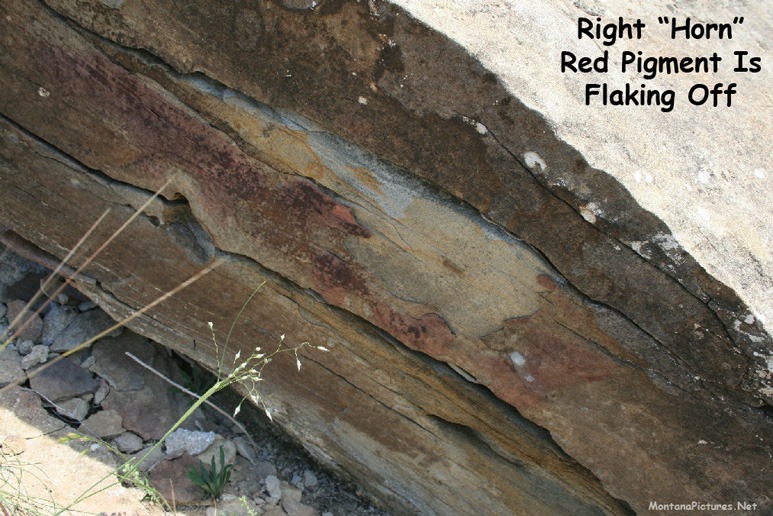
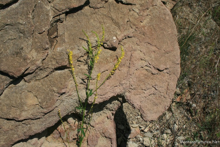
Over 40 plus years ago the Montana legislature passed a law that allowed landowners to designate their land as private by spraying objects on their property with 50 square inches of florescent orange paint to notify visitors there was no public access. Over 400 (?) years ago someone else in the Missouri Breaks used red pigment to notify visitors that they were trespassing.
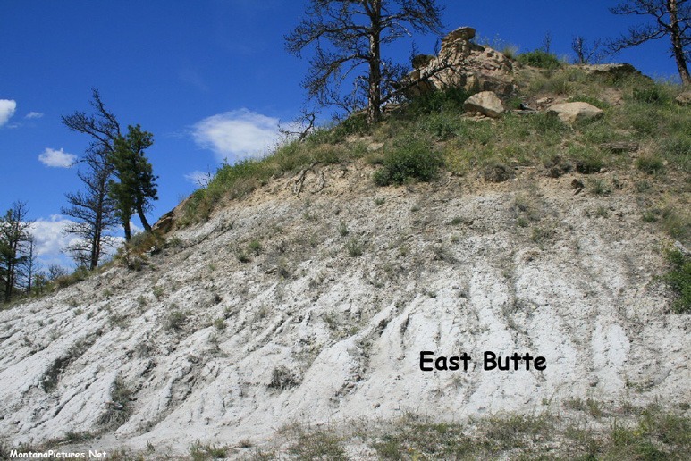
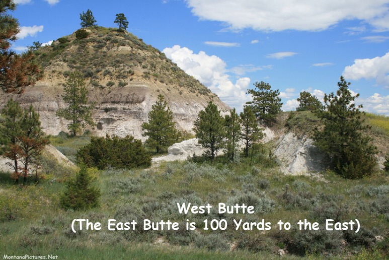
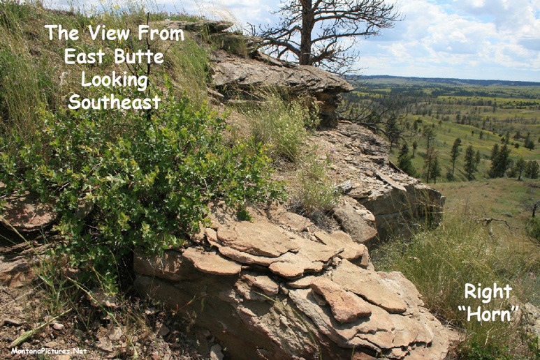
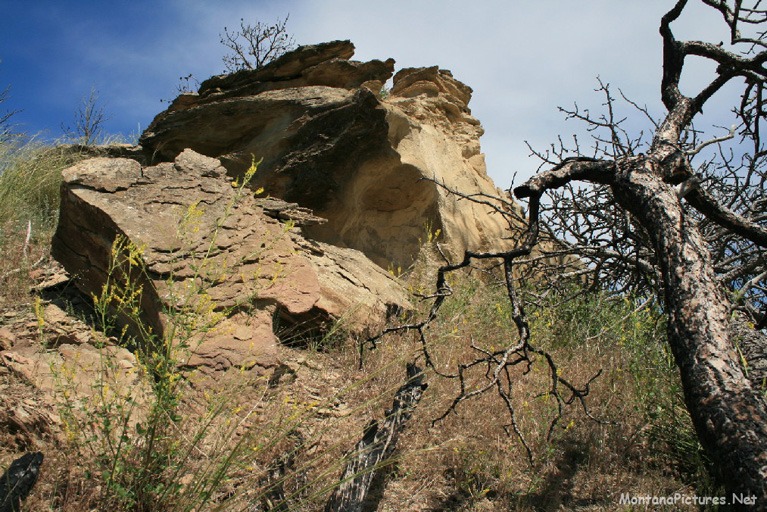
South of the Missouri River are two unique looking buttes. The West Butte is bare of human activity but the East Butte is striking. Perched on top of the East Butte is an eroded rock that looks exactly like a Bison Skull from above. The Skull and rock underneath is slathered red pigment. Go the Medicine Rocks Tour to learn more about the use of the red pigment on prominent rock features.
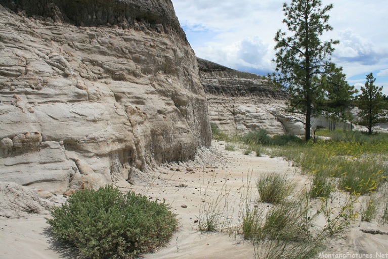
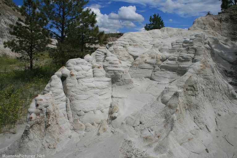
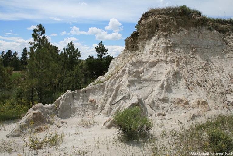
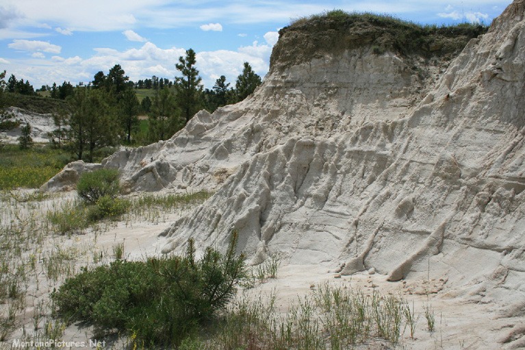
Sedimentary “Pillows”
If Archaeology doesn’t interest you, the “Pillow” outcrops of the nearby Hell Creek Formation might capture your imagination. The white chalky formations, pictured in the last row of photos, are composed of freshwater clays, mudstones and sandstones deposited during the last part of the Cretaceous period. The ancient mud contains an impressive Fossil Record that ranges from microscopic plants to gigantic dinosaurs such as Tyrannosaurus and Triceratops.
Leave only Tracks. Take only Pictures
Please leave it where you found it. The collection of fossil material is illegal unless done under a permit from the appropriate Federal land management agency. If you think you have found a fossil on National Park, U.S Bureau of Reclamation, or BLM lands, please contact a Federal land management representative.
Watch Dust “Comets” fly down nearby Hell Creek Road

Recent Comments