
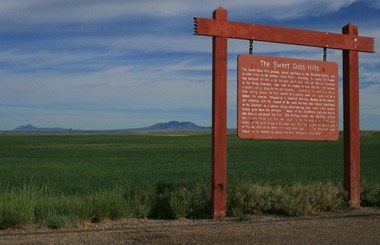
Welcome to the Sweet Grass Hills in Montana : Information and Photographs
Europe has man-made “Roman Roads” that date back 1,800 years. Montana has Buffalo/Bison roads that are just as old, near Gold Butte. The 2,000 pound animals would climb from the hot prairie to the shoulders of Gold Butte to escape the heat and insects. Centuries of pounding hoofs from bison created rock patches that are smooth and level and still visible today.
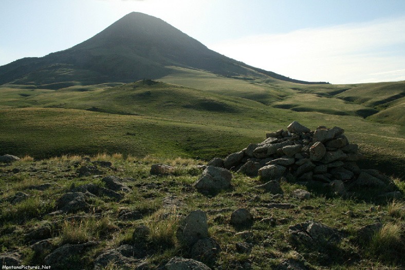
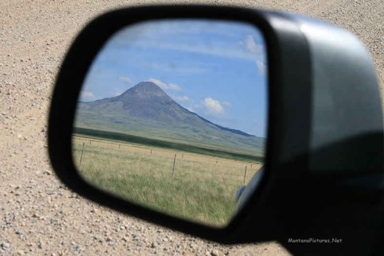
If you love history and incredible views you will be fascinated by the the Sweet Grass Hills in northern Montana. As you can see in the sunrise and sunset pictures Gold Butte (above), the hills are beautiful from the road but to really experience this sacred area you need to climb to the summits of Gold Butte, East Butte and West Butte.
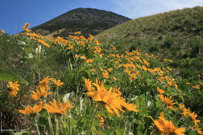
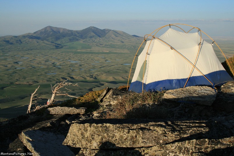
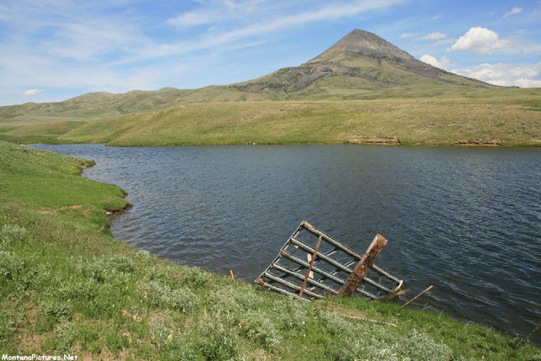
The Sweet Grass Hills are one hundred and fifteen Miles from Great Falls, Montana and there are only two days in a weekend. So make the most of it. Ride north into the Sweet Grass Hills well into the night. Pop your tent along the roadside for a peaceful night then enjoy the magical morning of wildflowers, cool breezes and if you are lucky, an elk or two. With an early start your chances of seeing some of the four hundred Sweet Grass Hills Elk are pretty good.
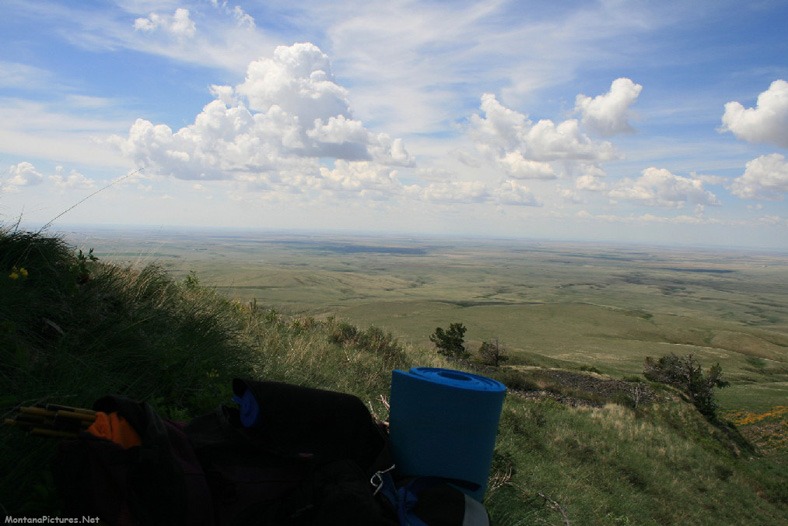
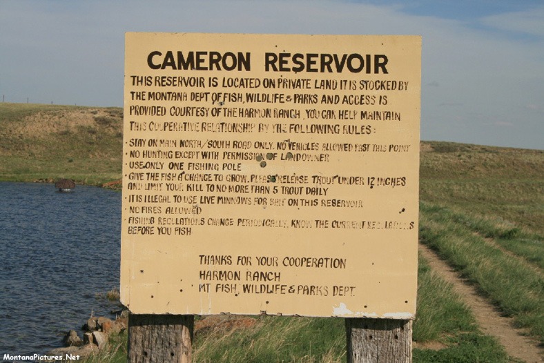
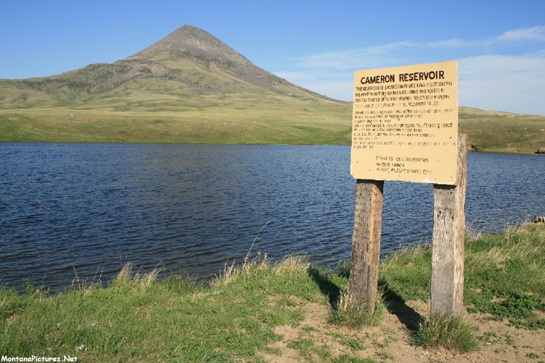
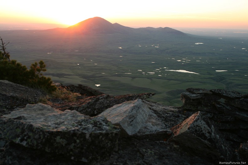
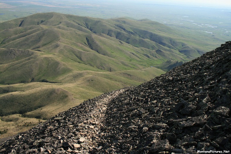
Sun is coming up in Montana (below). Put down the Maple Bar because we’re hiking to a special summit. Here is a morning view of Gold Butte near Cameron Reservoir in the Sweet Grass Hills. It’s only a six mile walk from Cameron Reservoir to the summit of Gold Butte (6512 feet) but you will want to allow plenty of time to explore the history and soak up the hundred mile views of the surrounding country side.
You Are Not The First To Visit
Archaeological evidence indicates that native people camped at nearby Writing-On-Stone as long as 3000 years ago. For centuries, native people created petroglyphs (rock carvings) and pictographs (rock paintings) on the sandstone cliffs along the Milk River. Although some of the rock art may be 3000 years old, the date of the first appearance of rock art at Writing-On-Stone remains uncertain.
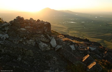
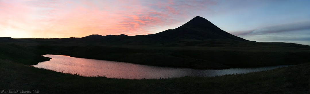
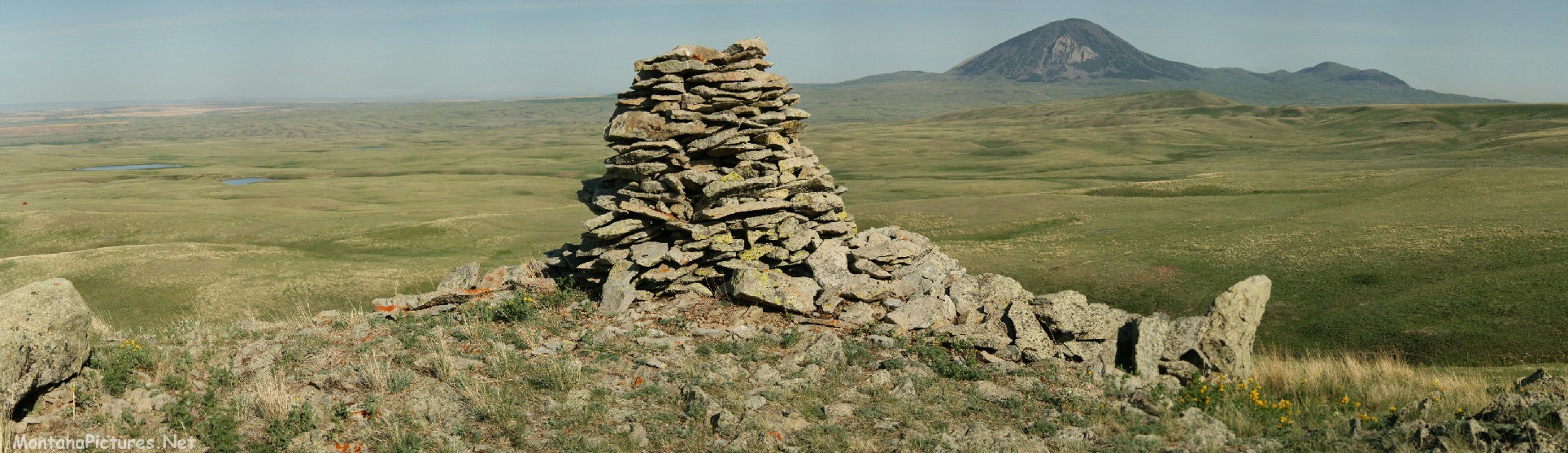
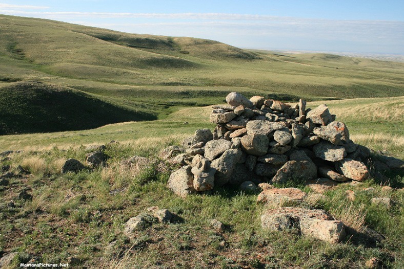
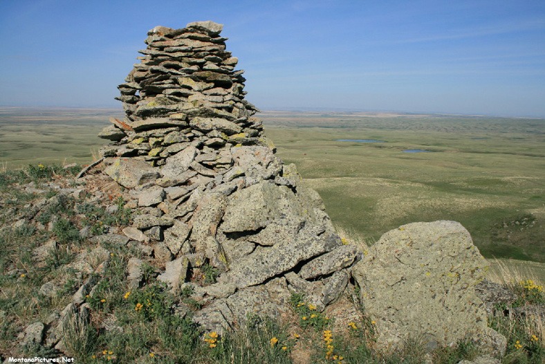
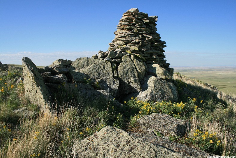
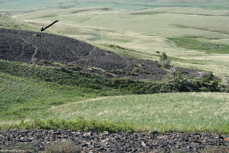
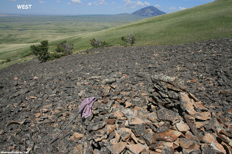
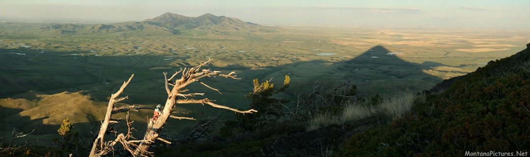
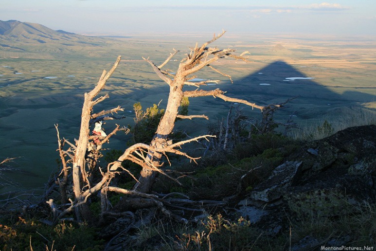
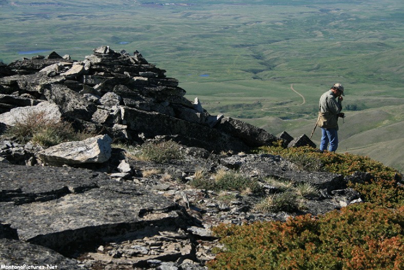
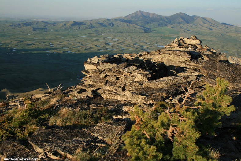
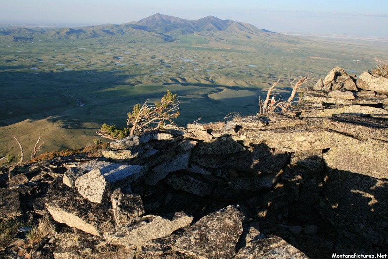
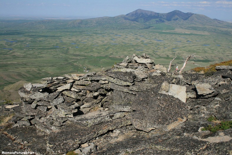
To get an idea of the man made rock structures near Gold Butte in the Sweet Grass Hills. hold out your hand palm side up. In your palm is Gold Butte (elevation of 6512 feet). Point your hand towards the southern horizon, spread your fingers as wide as you can and at the end of each finger you will find a five-foot-tall rock cairn. In the panorama, the water nearest the rock cairn is Cameron Reservoir. That’s West Butte on the horizon.
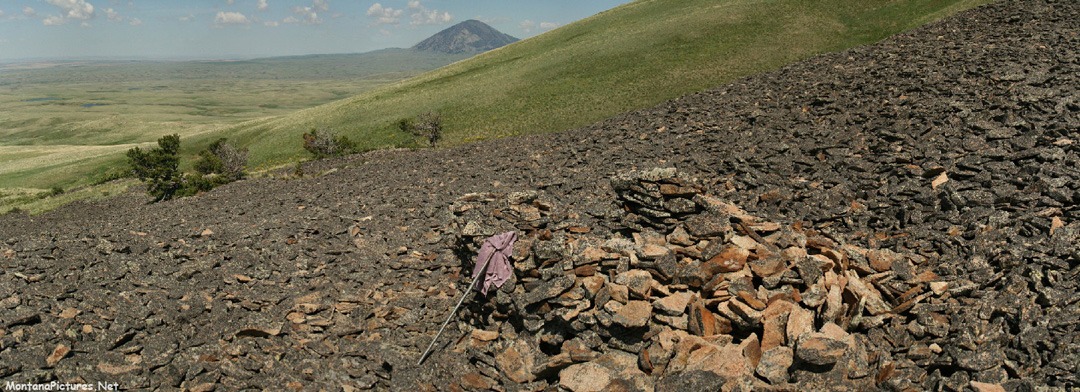
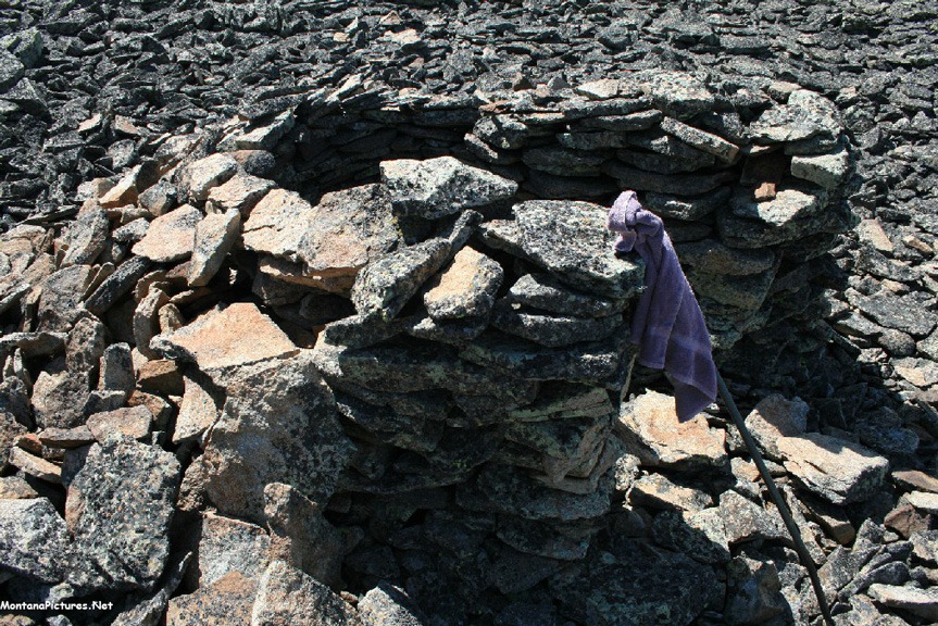
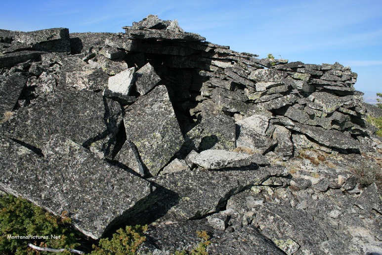
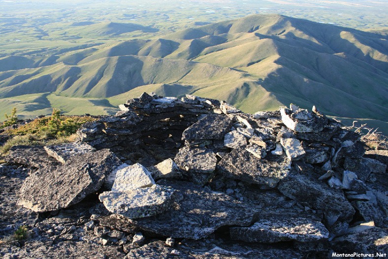
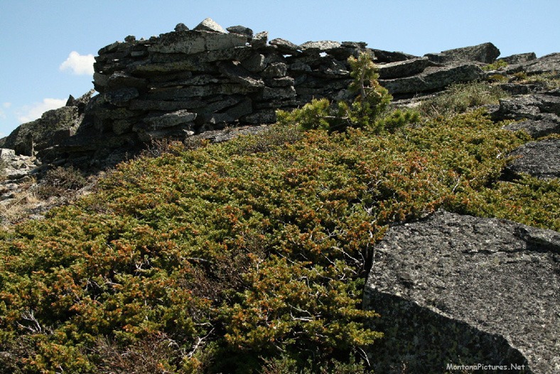
During the six mile walk to the summit of the summit of Gold Butte (6512 feet) we were surprised to see a rock structure in the talus field of rock (below). Some speculate it was once a hunting blind others say it’s an “Eagle Catch.” For scale -The walking staff is 48 inches long. Why is the entrance facing west towards the prevailing wind?
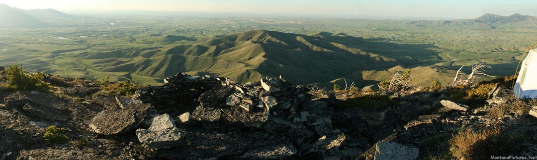
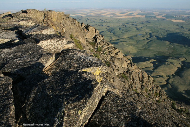
GOLD BUTTE SUMMIT VIEWS
Here is a little bit of everything June panorama from the summit of Gold Butte in Montana’s Sweet Grass Hills. West Butte (L) above the rock structure, Alberta (C) and above the tent is East Butte (R). The sunset view from Gold Butte reveals all the bodies of water scattered across the land that you don’t see from Highway 2.
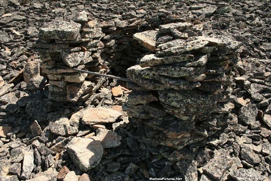
There is a side-by-side rock structure on Gold Butte in Montana’s Sweet Grass Hills. To describe the structure, picture a letter “S” laying on its’ side. One half of the letter “S” is covered by a rock roof (facing north) the other half of the letter “S” is open (facing south).
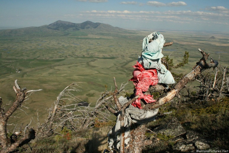
On the summit of Gold Butte and East Butte you will prayer cloth or Ribbon Trees that were placed by indigenous communities that have historic ties to this landscape. The prayer cloth are deeply personal and represent the prayers, hopes and aspirations of ceremony participants. Because of the need for privacy for certain ceremonies, ribbon trees tend to appear in remote areas. If you happen to see or come across ribbon trees please keep in mind they are sacred.

Recent Comments